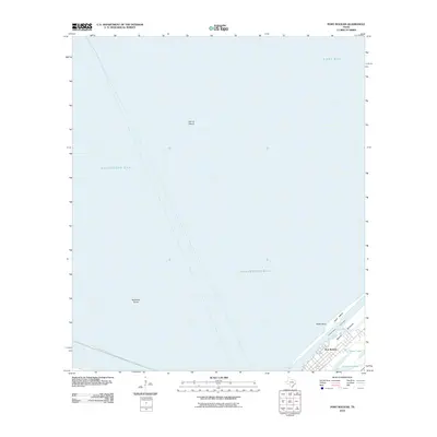
2010 Map of Port Bolivar
USGS Topo · Published 2010About this map
Port Bolivar serves as the focal point of this coastal survey, situated at the southwestern tip of the Bolivar Peninsula. The map documents the vital maritime infrastructure of the region, including the heavily trafficked Intracoastal Waterway and the long reach of the Texas City Dike Rd extending into Galveston Bay. This digital-era topographic record captures the fragile coastline and marshlands before significant modern changes, illustrating the proximity of the settlement to natural features like Oyster Lake and Horseshoe Lake.
Find a feature on this map
13 named features on this map. Tap any name to fly to it.
Don’t see what you’re looking for? This feature index may not catch every label — zoom into the map to look around manually.
Map Details
Editions of this 2010 Port Bolivar Map
This is the sole edition of this map. No revisions or reprints were ever made.
Other maps of this area

1929 · Virginia Point
USGS Topo · 1:24,000

1929 · Texas City
USGS Topo · 1:24,000

1930 · Galveston
USGS Topo · 1:24,000

1931 · Flake
USGS Topo · 1:24,000

1932 · Clifton By The Sea
USGS Topo · 1:31,680

1932 · Texas City
USGS Topo · 1:31,680

1932 · Bolivar Point
USGS Topo · 1:24,000

1932 · Virginia Point
USGS Topo · 1:31,680

1933 · The Jetties
USGS Topo · 1:31,680

1933 · Whites Lake
USGS Topo · 1:31,680