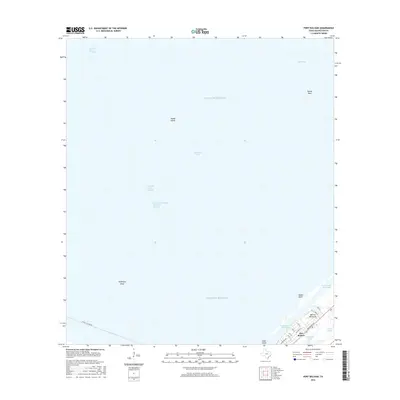
2016 Map of Port Bolivar
USGS Topo · Published 2016About this map
Port Bolivar serves as the focal point of this maritime-heavy survey, situated at the tip of the Bolivar Peninsula where the Gulf of Mexico meets the entrance to the busy Texas shipping lanes. The map provides a look at the complex aquatic geography of the region, highlighting the deep-water Houston Ship Channel and the Houston/Galveston Navigation Channel that facilitate heavy commerce. Along the coastline, smaller water bodies like Horseshoe Lake and Oyster Lake provide a sharp contrast to the open expanse of Galveston Bay and East Bay. Navigational hazards and landmarks define the waters surrounding the peninsula, including Hanna Reef, Hanna Island, and the submerged Halfmoon Shoal. The transportation network is anchored by local thoroughfares such as Broadway Ave and Texas City Dike Rd, while the Intracostal Waterway cuts through the marshes near Baffle Point.
Find a feature on this map
26 named features on this map. Tap any name to fly to it.
Don’t see what you’re looking for? This feature index may not catch every label — zoom into the map to look around manually.
Map Details
Editions of this 2016 Port Bolivar Map
This is the sole edition of this map. No revisions or reprints were ever made.
Other maps of this area

1929 · Virginia Point
USGS Topo · 1:24,000

1929 · Texas City
USGS Topo · 1:24,000

1930 · Galveston
USGS Topo · 1:24,000

1931 · Flake
USGS Topo · 1:24,000

1932 · Clifton By The Sea
USGS Topo · 1:31,680

1932 · Texas City
USGS Topo · 1:31,680

1932 · Bolivar Point
USGS Topo · 1:24,000

1932 · Virginia Point
USGS Topo · 1:31,680

1933 · The Jetties
USGS Topo · 1:31,680

1933 · Whites Lake
USGS Topo · 1:31,680