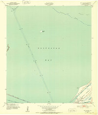
1943 Map of Port Bolivar
USGS Topo · Published 1952About this map
Galveston Bay and the narrow tip of the Bolivar Peninsula dominate this mid-century maritime survey, documenting the critical shipping arteries serving the Texas coast. The strategic importance of the peninsula is evident at the settlement of Port Bolivar, where Fort Travis and several Observation Towers overlook the water. These military and navigational aids guarded the entrance to the bay during and after the war years.
Find a feature on this map
17 named features on this map. Tap any name to fly to it.
Don’t see what you’re looking for? This feature index may not catch every label — zoom into the map to look around manually.
Map Details
Editions of this 1943 Port Bolivar Map
This is the sole edition of this map. No revisions or reprints were ever made.
Other maps of this area

1929 · Virginia Point
USGS Topo · 1:24,000

1929 · Texas City
USGS Topo · 1:24,000

1930 · Galveston
USGS Topo · 1:24,000

1931 · Flake
USGS Topo · 1:24,000

1932 · Clifton By The Sea
USGS Topo · 1:31,680

1932 · Texas City
USGS Topo · 1:31,680

1932 · Bolivar Point
USGS Topo · 1:24,000

1932 · Virginia Point
USGS Topo · 1:31,680

1933 · The Jetties
USGS Topo · 1:31,680

1933 · Whites Lake
USGS Topo · 1:31,680