
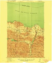
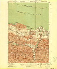
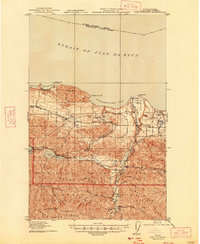
1919 Map of Port Crescent
USGS Topo · Published 1919About this map
The Juan De Fuca Strait shoreline reveals a period of transition on the Olympic Peninsula, where the timber industry and early infrastructure were reshaping the landscape. While Port Crescent is already noted as a defunct settlement, the surrounding area thrives with activity at Joyce, Ramapo, and Piedmont. The rugged topography of the Olympic National Forest is accessible via the Olympic Highway and the Seattle Ramapo railroad, reflecting the vital connections between the interior forests and the coastal bays.
Find a feature on this map
51 named features on this map. Tap any name to fly to it.
Don’t see what you’re looking for? This feature index may not catch every label — zoom into the map to look around manually.
Map Details
Editions of this 1919 Port Crescent Map
4 editions found
Other maps of this area

1918 · Port Angeles
USGS Topo · 1:62,500

1918 · Lake Crescent
USGS Topo · 1:62,500

1922 · Lake Crescent
USGS Topo · 1:62,500

1935 · Mount Olympus
USGS Topo · 1:62,500

1938 · Mt Constance
USGS Topo · 1:125,000

1939 · Mount Tom
USGS Topo · 1:62,500

1941 · Port Angeles
USGS Topo · 1:62,500

1942 · Mount Olympus
USGS Topo · 1:62,500

1944 · Mt. Angeles
USGS Topo · 1:62,500

1946 · Mt. Angeles
USGS Topo · 1:62,500