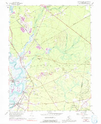
1956 Map of Port Elizabeth
USGS Topo · Published 1992About this map
The Maurice River serves as the dominant geographic feature of this mid-century survey, anchoring a string of historic maritime and industrial settlements including Port Elizabeth, Mauricetown, and Leesburg. The landscape is defined by the transition from tidal riverbanks to the dense woodlands of the Belleplain State Forest. The influence of the Pennsylvania Reading Seashore Lines is evident as it cuts through the territory, linking small communities like Bricksboro and Dorchester to the broader regional economy. Significant extractive activity is visible through numerous Gravel Pits and Sand and Gravel Pits scattered near Muskee Hill and Halberton. Local waterpower and early industry are marked by sites such as Jones Mill and Hoffmans Mill, while the lowlands near West Creek show specialized land use with a mapped Cranberry Bog. This map captures a moment of established rural infrastructure before modern development patterns altered the character of Cumberland County.
Find a feature on this map
49 named features on this map. Tap any name to fly to it.
Don’t see what you’re looking for? This feature index may not catch every label — zoom into the map to look around manually.
Map Details
Editions of this 1956 Port Elizabeth Map
4 editions found
Other maps of this area

1888 · Dennisville
USGS Topo · 1:62,500

1890 · Tuckahoe
USGS Topo · 1:62,500

1890 · Maurice Cove
USGS Topo · 1:62,500

1890 · Bridgeton
USGS Topo · 1:62,500

1891 · Maurice Cove
USGS Topo · 1:62,500

1893 · Tuckahoe
USGS Topo · 1:62,500

1894 · Dennisville
USGS Topo · 1:62,500

1894 · Bridgeton
USGS Topo · 1:62,500

1899 · Vineland
USGS Topo · 1:125,000

1918 · Tuckahoe
USGS Topo · 1:62,500