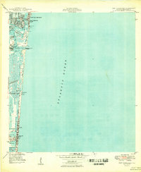
1949 Map of Port Everglades
USGS Topo · Published 1949About this map
The Atlantic coastline of Broward County is defined by a complex network of barrier islands and tidal inlets just after World War II. The development of Fort Lauderdale and Hollywood is centered on the Intracoastal Waterway, which serves as the primary artery for coastal navigation. At Port Everglades, the deep-water Turning Basin and North Jetty mark a significant era of maritime engineering designed to facilitate heavy shipping traffic.
Find a feature on this map
34 named features on this map. Tap any name to fly to it.
Don’t see what you’re looking for? This feature index may not catch every label — zoom into the map to look around manually.
Map Details
Editions of this 1949 Port Everglades Map
2 editions found
Other maps of this area

1945 · Fort Lauderdale North
USGS Topo · 1:24,000

1947 · North Miami
USGS Topo · 1:24,000

1949 · Fort Lauderdale North
USGS Topo · 1:24,000

1949 · Port Everglades
USGS Topo · 1:24,000

1949 · Fort Lauderdale South
USGS Topo · 1:24,000

1949 · Pompano Beach
USGS Topo · 1:24,000

1950 · North Miami
USGS Topo · 1:24,000

1956 · Miami
USGS Topo · 1:250,000

1956 · West Palm Beach
USGS Topo · 1:250,000

1957 · West Palm Beach
USGS Topo · 1:250,000
Featured Places
- Fort Lauderdale, FL
- Harbor Beach, Fort Lauderdale
- Harbor Heights, Fort Lauderdale
- Nurmi Isles, Fort Lauderdale
- Rio Vista Isles, Fort Lauderdale