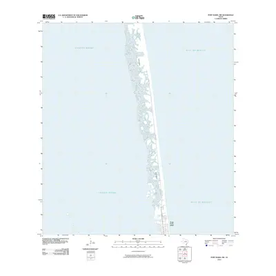
2010 Map of Port Isabel NW
USGS Topo · Published 2010About this map
Padre Island stretches as a narrow barrier between the expansive Laguna Madre and the open Gulf of Mexico in this coastal survey. The map details the northern reaches of the South Padre Island settlement as it stood in the early 21st century, showing the established grid of streets and development concentrated at the southern end of the landmass. Beyond the immediate town limits, the landscape transitions into the characteristic shoreline of the barrier island, where the primary infrastructure consists of Padre Blvd and Ocean Blvd. The contrast between the sheltered waters of the lagoon and the active surf of the gulf coast illustrates the delicate geography of this South Texas region, where the mainland is separated from the sea by this thin ribbon of sand and marshland.
Find a feature on this map
6 named features on this map. Tap any name to fly to it.
Don’t see what you’re looking for? This feature index may not catch every label — zoom into the map to look around manually.
Map Details
Editions of this 2010 Port Isabel NW Map
This is the sole edition of this map. No revisions or reprints were ever made.
Other maps of this area

1929 · La Coma
USGS Topo · 1:24,000

1929 · Point Isabel
USGS Topo · 1:24,000

1929 · Buena Vista
USGS Topo · 1:24,000

1929 · Laguna Vista
USGS Topo · 1:24,000

1930 · Padre Island No. 1
USGS Topo · 1:24,000

1930 · Padre Island No. 2
USGS Topo · 1:24,000

1934 · Port Isabel
USGS Topo · 1:31,680

1934 · La Coma
USGS Topo · 1:31,680

1935 · Padre Island No 1
USGS Topo · 1:31,680

1935 · Padre Island NO. 2
USGS Topo · 1:31,680