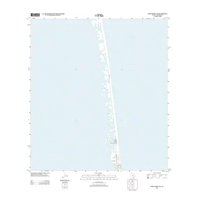
2013 Map of Port Isabel NW
USGS Topo · Published 2013About this map
The coastal barrier landscape of South Padre Island is defined by its slender profile and shifting shoreline along the Gulf of Mexico. In this 2013 survey, the development is concentrated along the southern reach of the quadrangle, where a tight grid of residential and commercial streets serves the seaside community. Primary transit is managed through Padre Blvd, which acts as the central artery for the developed spit. Lateral streets such as Main St, Snore Dr, and Parade Dr connect the bay side of the island toward the beachfront, where Gulf Blvd and Ocean Blvd provide direct access to the water. North of this developed pocket, the map reveals a largely untouched expanse of sand and tidal flats, illustrating the contrast between modern vacation infrastructure and the raw coastal environment of Cameron County.
Find a feature on this map
8 named features on this map. Tap any name to fly to it.
Don’t see what you’re looking for? This feature index may not catch every label — zoom into the map to look around manually.
Map Details
Editions of this 2013 Port Isabel NW Map
This is the sole edition of this map. No revisions or reprints were ever made.
Other maps of this area

1929 · La Coma
USGS Topo · 1:24,000

1929 · Point Isabel
USGS Topo · 1:24,000

1929 · Buena Vista
USGS Topo · 1:24,000

1929 · Laguna Vista
USGS Topo · 1:24,000

1930 · Padre Island No. 1
USGS Topo · 1:24,000

1930 · Padre Island No. 2
USGS Topo · 1:24,000

1934 · Port Isabel
USGS Topo · 1:31,680

1934 · La Coma
USGS Topo · 1:31,680

1935 · Padre Island No 1
USGS Topo · 1:31,680

1935 · Padre Island NO. 2
USGS Topo · 1:31,680