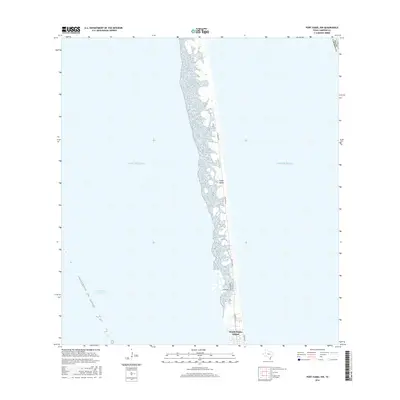
2016 Map of Port Isabel NW
USGS Topo · Published 2016About this map
Padre Island stretches across this coastal survey, showcasing the narrow barrier island environment of Cameron County during the mid-2010s. The landscape is defined by the stark contrast between the open Gulf of Mexico to the east and the protected Intracoastal Waterway to the west. While much of the northern reach consists of undeveloped terrain and shoreline, the southern portion transitions into the early street grid of South Padre Island. Detailed road networks including Padre Blvd, Gulf Blvd, and Ocean Blvd illustrate the concentration of development at the island's southern tip, providing a clear record of the area's footprint before subsequent coastal shifts or further expansion.
Find a feature on this map
9 named features on this map. Tap any name to fly to it.
Don’t see what you’re looking for? This feature index may not catch every label — zoom into the map to look around manually.
Map Details
Editions of this 2016 Port Isabel NW Map
This is the sole edition of this map. No revisions or reprints were ever made.
Other maps of this area

1929 · La Coma
USGS Topo · 1:24,000

1929 · Point Isabel
USGS Topo · 1:24,000

1929 · Buena Vista
USGS Topo · 1:24,000

1929 · Laguna Vista
USGS Topo · 1:24,000

1930 · Padre Island No. 1
USGS Topo · 1:24,000

1930 · Padre Island No. 2
USGS Topo · 1:24,000

1934 · Port Isabel
USGS Topo · 1:31,680

1934 · La Coma
USGS Topo · 1:31,680

1935 · Padre Island No 1
USGS Topo · 1:31,680

1935 · Padre Island NO. 2
USGS Topo · 1:31,680