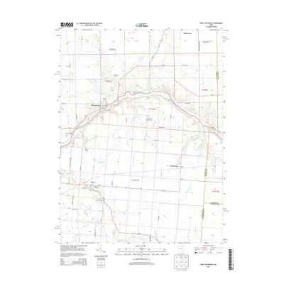
2013 Map of Port Jefferson
USGS Topo · Published 2013About this map
The Great Miami River winds through this Shelby County landscape, providing a natural anchor for the historic villages of Port Jefferson and Pasco. The area is defined by a dense network of drainage and creek systems, including Turkeyfoot Cr, Manning Run, and Mosquito Cr, which have historically supported the agricultural character of the region. Local genealogy is well-preserved through numerous small burial grounds such as Pioneer Cem, Roberts Cem, and Old Dunkard Cem, each marking the settlement history of families who established farms along the river valley. The map reveals the layout of established hamlets like Pemberton and Maplewood, alongside modern developments such as Mill Valley Farms. This survey captures the transition between the small-town infrastructure of the early 20th century and the contemporary road networks of Oh-47 and Oh-29 that now connect these rural communities.
Find a feature on this map
61 named features on this map. Tap any name to fly to it.
Don’t see what you’re looking for? This feature index may not catch every label — zoom into the map to look around manually.
Map Details
Editions of this 2013 Port Jefferson Map
This is the sole edition of this map. No revisions or reprints were ever made.
Other maps of this area

1913 · Bellefontaine
USGS Topo · 1:48,000

1913 · Sidney
USGS Topo · 1:62,500

1914 · Troy
USGS Topo · 1:62,500

1914 · St. Paris
USGS Topo · 1:62,500

1915 · Bellefontaine
USGS Topo · 1:62,500

1916 · St. Paris
USGS Topo · 1:62,500

1944 · Sidney
USGS Topo · 1:62,500

1944 · St. Paris
USGS Topo · 1:62,500

1944 · Troy
USGS Topo · 1:62,500

1944 · Bellefontaine
USGS Topo · 1:62,500