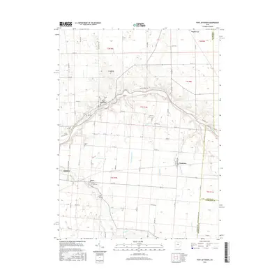
2016 Map of Port Jefferson
USGS Topo · Published 2016About this map
The Great Miami River cuts through the center of this Shelby County landscape, anchoring the settlement of Port Jefferson. This area serves as a significant hydraulic junction where Line Run and Counts Run meet the river's main stem. The western edge of the map captures the outskirts of Sidney, while the small villages of Pemberton, Pasco, and Maplewood are distributed along the rural road network. Genealogists will find several notable burial sites including the Pioneer Cem and Old Dunkard Cem. The terrain is defined by a dense network of drainage ditches and creeks, such as Reeder Ditch and Turkeyfoot Cr, which support the agricultural development spanning the intersection of Shelby, Logan, and Champaign counties.
Find a feature on this map
54 named features on this map. Tap any name to fly to it.
Don’t see what you’re looking for? This feature index may not catch every label — zoom into the map to look around manually.
Map Details
Editions of this 2016 Port Jefferson Map
This is the sole edition of this map. No revisions or reprints were ever made.
Other maps of this area

1913 · Bellefontaine
USGS Topo · 1:48,000

1913 · Sidney
USGS Topo · 1:62,500

1914 · Troy
USGS Topo · 1:62,500

1914 · St. Paris
USGS Topo · 1:62,500

1915 · Bellefontaine
USGS Topo · 1:62,500

1916 · St. Paris
USGS Topo · 1:62,500

1944 · Sidney
USGS Topo · 1:62,500

1944 · St. Paris
USGS Topo · 1:62,500

1944 · Troy
USGS Topo · 1:62,500

1944 · Bellefontaine
USGS Topo · 1:62,500