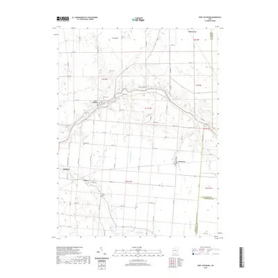
2019 Map of Port Jefferson
USGS Topo · Published 2019About this map
The Great Miami River winds through the heart of Shelby County, anchoring a landscape defined by its agricultural heritage and early 19th-century settlements. Port Jefferson and Pemberton serve as the primary hubs, surrounded by a dense network of township and county roads that follow the rigid section lines of the Public Land Survey System. The map reveals a high concentration of burial grounds, providing valuable data for genealogical research. Notable sites include the Old Dunkard Cem and the Pioneer Cem near the river, as well as the Cedar Point Cem in Pasco. The terrain is drained by numerous small waterways such as Leatherwood Cr, Turkeyfoot Cr, and Mosquito Cr, which intersect with a rural infrastructure of named roads like Lefevre Number 2 Rd and Pasco Montra Rd.
Find a feature on this map
81 named features on this map. Tap any name to fly to it.
Don’t see what you’re looking for? This feature index may not catch every label — zoom into the map to look around manually.
Map Details
Editions of this 2019 Port Jefferson Map
This is the sole edition of this map. No revisions or reprints were ever made.
Other maps of this area

1913 · Bellefontaine
USGS Topo · 1:48,000

1913 · Sidney
USGS Topo · 1:62,500

1914 · Troy
USGS Topo · 1:62,500

1914 · St. Paris
USGS Topo · 1:62,500

1915 · Bellefontaine
USGS Topo · 1:62,500

1916 · St. Paris
USGS Topo · 1:62,500

1944 · Sidney
USGS Topo · 1:62,500

1944 · St. Paris
USGS Topo · 1:62,500

1944 · Troy
USGS Topo · 1:62,500

1944 · Bellefontaine
USGS Topo · 1:62,500