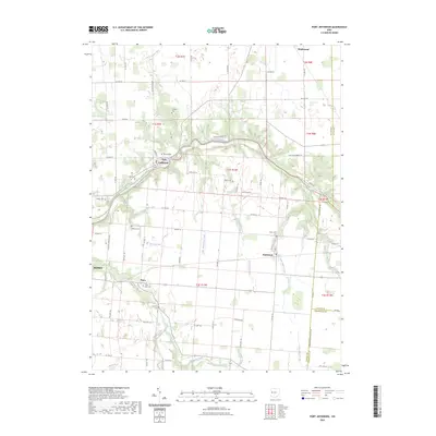
2023 Map of Port Jefferson
USGS Topo · Published 2023About this map
The Great Miami River winds through this section of Shelby County, anchoring the riverside village of Port Jefferson. This landscape is defined by the sharp transition between the upland agricultural plains and the wooded valleys carved by waterways like Turkeyfoot Creek and Indian Creek. Small crossroads settlements including Pemberton and Pasco mark the intersections of rural county highways, serving as local centers for the surrounding farming community.
Find a feature on this map
74 named features on this map. Tap any name to fly to it.
Don’t see what you’re looking for? This feature index may not catch every label — zoom into the map to look around manually.
Map Details
Editions of this 2023 Port Jefferson Map
This is the sole edition of this map. No revisions or reprints were ever made.
Other maps of this area

1913 · Bellefontaine
USGS Topo · 1:48,000

1913 · Sidney
USGS Topo · 1:62,500

1914 · Troy
USGS Topo · 1:62,500

1914 · St. Paris
USGS Topo · 1:62,500

1915 · Bellefontaine
USGS Topo · 1:62,500

1916 · St. Paris
USGS Topo · 1:62,500

1944 · Sidney
USGS Topo · 1:62,500

1944 · St. Paris
USGS Topo · 1:62,500

1944 · Troy
USGS Topo · 1:62,500

1944 · Bellefontaine
USGS Topo · 1:62,500