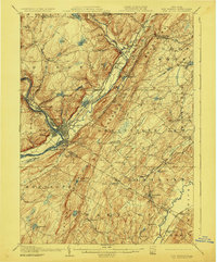
1908 Map of Port Jervis
USGS Topo · Published 1923About this map
The junction of New York, New Jersey, and Pennsylvania defines this geographic study, centering on the strategic hub of Port Jervis. This landscape is marked by the convergence of the Delaware River and Neversink River, with the Shawangunk Mountains and Mount Hope rising sharply from the valleys. Historic landmarks like Tristate Rock and Carpenters Pt anchor the border crossing near Matamoras, while the complex rail infrastructure of the Erie RR and New York Ontario and Western RR facilitates trade through the river corridor.
Find a feature on this map
91 named features on this map. Tap any name to fly to it.
Don’t see what you’re looking for? This feature index may not catch every label — zoom into the map to look around manually.
Map Details
Editions of this 1908 Port Jervis Map
4 editions found

Other maps of this area

1888 · Franklin
USGS Topo · 1:62,500

1891 · Greenwood Lake
USGS Topo · 1:62,500

1891 · Wallpack
USGS Topo · 1:62,500

1893 · Greenwood Lake
USGS Topo · 1:62,500

1893 · Wallpack
USGS Topo · 1:62,500

1894 · Franklin
USGS Topo · 1:62,500

1897 · Franklin
USGS Topo · 1:62,500

1903 · Franklin Furnace
USGS Topo · 1:62,500

1903 · Greenwood Lake
USGS Topo · 1:62,500

1904 · Ellenville
USGS Topo · 1:62,500