
1953 Map of Port Moller
USGS Topo · Published 1953About this map
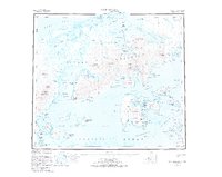
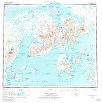
Nelson Lagoon Cannery stands as a focal point of industrial activity on the northern coast of the Alaska Peninsula, where the tidal flats of Nelson Lagoon meet the Bering Sea. This mid-century survey illustrates a landscape defined by the transition from the maritime commerce of Port Moller and Balboa Bay to the active volcanic peaks of the interior, such as Pavlof Volcano and Mt Dana. The distribution of Cabins, Burns Cabins, and a Village near the coast highlights the seasonal and subsistence-based settlement patterns of the era. To the south, the Dolgoi Naval Reserve and the Naval Reserve Boundary indicate the strategic geopolitical importance of the Pavlof Islands and Unga Island during the post-war period. The terrain is marked by significant landmarks like Staniukovich Mtn and the numerous inlets of the Kudobin Islands, offering a detailed view of the coastline before modern developments.
Find a feature on this map
201 named features on this map. Tap any name to fly to it.
Don’t see what you’re looking for? This feature index may not catch every label — zoom into the map to look around manually.
Map Details
Editions of this 1953 Port Moller Map
3 editions found
Other maps of this area

1943 · Fort Randall
USGS Topo · 1:250,000

1949 · False Pass
USGS Topo · 1:250,000

1949 · Fort Randall
USGS Topo · 1:250,000

1950 · False Pass
USGS Topo · 1:250,000

1950 · Fort Randall
USGS Topo · 1:250,000

1951 · Stepovak Bay
USGS Topo · 1:250,000

1963 · Port Moller D-5
USGS Topo · 1:63,360

1963 · Port Moller A-5
USGS Topo · 1:63,360
1963 · Port Moller A-4
USGS Topo · 1:63,360

1963 · Port Moller C-5
USGS Topo · 1:63,360