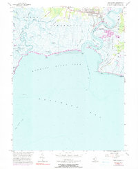
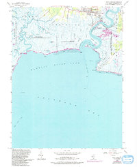
1956 Map of Port Norris
USGS Topo · Published 1991About this map
Port Norris and the surrounding marshlands of Downe and Commercial townships define this coastal reach during the mid-20th century. The oyster-fishing economy is physically manifest in the riverside settlements of Bivalve and Shell Pile, where a wharf and specialized ditching like Sanitary Ditch supported the local industry. The map captures a high level of community detail, including St Anthonys Ch, Wesley Ch, and the Brown Sch, alongside a complex network of waterways such as Dividing Creek and Maurice River. The transition from the developed village to the vast Maurice River Cove is marked by expansive Tidal Flats and protected areas like the State Hunting and Fishing Grounds, providing a look at the ecological and industrial balance of the Delaware Bay shoreline.
Find a feature on this map
48 named features on this map. Tap any name to fly to it.
Don’t see what you’re looking for? This feature index may not catch every label — zoom into the map to look around manually.
Map Details
Editions of this 1956 Port Norris Map
5 editions found
Other maps of this area

1888 · Dennisville
USGS Topo · 1:62,500

1890 · Tuckahoe
USGS Topo · 1:62,500

1890 · Maurice Cove
USGS Topo · 1:62,500

1890 · Bridgeton
USGS Topo · 1:62,500

1891 · Maurice Cove
USGS Topo · 1:62,500

1893 · Tuckahoe
USGS Topo · 1:62,500

1894 · Dennisville
USGS Topo · 1:62,500

1894 · Bridgeton
USGS Topo · 1:62,500

1899 · Vineland
USGS Topo · 1:125,000

1918 · Tuckahoe
USGS Topo · 1:62,500
Featured Places
- Maurice River Township, NJ
- Commercial Township, NJ
- Downe Township, NJ
- Port Norris, Commercial Township
- Bivalve, Commercial Township