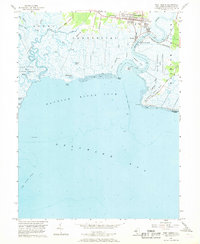
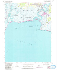
1956 Map of Port Norris
USGS Topo · Published 1968About this map
Port Norris and the surrounding marshlands of Commercial and Downe townships dominate this mid-century coastal survey. The working waterfronts of Bivalve and Shell Pile are clearly detailed along the banks of the Maurice River, reflecting the region's historic ties to the oyster and fishing industries. Inland, the map documents a community defined by its institutions, including St Anthonys Ch, Shiloh Ch, and the Brown Sch.
Find a feature on this map
47 named features on this map. Tap any name to fly to it.
Don’t see what you’re looking for? This feature index may not catch every label — zoom into the map to look around manually.
Map Details
Editions of this 1956 Port Norris Map
5 editions found
Other maps of this area

1888 · Dennisville
USGS Topo · 1:62,500

1890 · Tuckahoe
USGS Topo · 1:62,500

1890 · Maurice Cove
USGS Topo · 1:62,500

1890 · Bridgeton
USGS Topo · 1:62,500

1891 · Maurice Cove
USGS Topo · 1:62,500

1893 · Tuckahoe
USGS Topo · 1:62,500

1894 · Dennisville
USGS Topo · 1:62,500

1894 · Bridgeton
USGS Topo · 1:62,500

1899 · Vineland
USGS Topo · 1:125,000

1918 · Tuckahoe
USGS Topo · 1:62,500
Featured Places
- Maurice River Township, NJ
- Commercial Township, NJ
- Downe Township, NJ
- Port Norris, Commercial Township
- Bivalve, Commercial Township