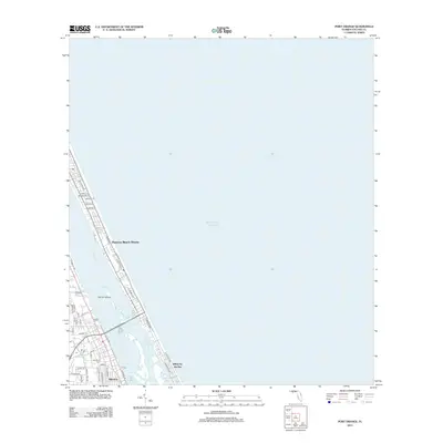
2012 Map of Port Orange
USGS Topo · Published 2012About this map
The coastal barrier island and the adjacent mainland of Volusia County are captured in this 2012 study, where the Halifax River serves as the central artery between residential neighborhoods and the Atlantic Ocean. Along the shoreline, Daytona Beach Shores and Wilbur-by-the-Sea occupy the narrow strip of land between the river and the sea, characterized by a dense grid of residential streets like La Paloma Ave. On the mainland side, the community of Allandale is established near the intersection of several local waterways, including the Reed Canal and Halifax Canal. For genealogists and local historians, the Woodland Cem stands as a primary landmark in the southern portion of the map. The natural landscape is further defined by protected areas like Pelican Island and the expansive waters of Wilbur Bay, illustrating the area's intricate balance of development and tidal wetlands.
Find a feature on this map
46 named features on this map. Tap any name to fly to it.
Don’t see what you’re looking for? This feature index may not catch every label — zoom into the map to look around manually.
Map Details
Editions of this 2012 Port Orange Map
This is the sole edition of this map. No revisions or reprints were ever made.
Other maps of this area

1937 · Port Orange
USGS Topo · 1:48,000

1937 · Ormond
USGS Topo · 1:48,000

1943 · Port Orange
USGS Topo · 1:62,500

1944 · Ormond
USGS Topo · 1:62,500

1944 · Port Orange
USGS Topo · 1:62,500

1952 · Samsula
USGS Topo · 1:24,000

1952 · Daytona Beach
USGS Topo · 1:24,000

1954 · Daytona Beach
USGS Topo · 1:250,000

1956 · Port Orange
USGS Topo · 1:24,000

1956 · New Smyrna Beach
USGS Topo · 1:24,000
Featured Places
- Daytona Beach, FL
- Daytona Beach Shores, FL
- Port Orange, FL
- Halifax Estates, Daytona Beach Shores
- Wilbur-by-the-Sea, FL