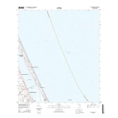
2015 Map of Port Orange
USGS Topo · Published 2015About this map
Daytona Beach and Port Orange are documented here along the Atlantic coast, showcasing the dense residential and commercial development of the Florida barrier islands and the mainland shoreline. The Halifax River serves as a central artery, separating the mainland settlements of South Daytona and Allandale from the beachfront communities of Daytona Beach Shores and Wilbur-by-the-Sea. This 2015 survey illustrates the intricate network of local streets, including S Ridgewood Ave and S Atlantic Ave, which define the region's north-south transit corridors.
Find a feature on this map
51 named features on this map. Tap any name to fly to it.
Don’t see what you’re looking for? This feature index may not catch every label — zoom into the map to look around manually.
Map Details
Editions of this 2015 Port Orange Map
This is the sole edition of this map. No revisions or reprints were ever made.
Other maps of this area

1937 · Port Orange
USGS Topo · 1:48,000

1937 · Ormond
USGS Topo · 1:48,000

1943 · Port Orange
USGS Topo · 1:62,500

1944 · Ormond
USGS Topo · 1:62,500

1944 · Port Orange
USGS Topo · 1:62,500

1952 · Samsula
USGS Topo · 1:24,000

1952 · Daytona Beach
USGS Topo · 1:24,000

1954 · Daytona Beach
USGS Topo · 1:250,000

1956 · Port Orange
USGS Topo · 1:24,000

1956 · New Smyrna Beach
USGS Topo · 1:24,000
Featured Places
- Daytona Beach, FL
- Daytona Beach Shores, FL
- Port Orange, FL
- Halifax Estates, Daytona Beach Shores
- Wilbur-by-the-Sea, FL