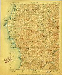
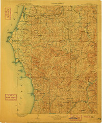
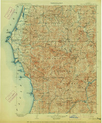
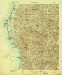
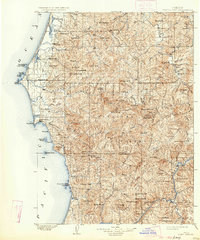
1903 Map of Port Orford
USGS Topo · Published 1908About this map
Port Orford serves as the coastal anchor for this region of Southwest Oregon, where the Pacific coastline meets the densely folded mountains of the Coast Range. Surveyed in the late 1890s, the map reveals a network of isolated settlements and maritime landmarks, including the L.h. at Cape Blanco. Moving inland, the landscape is defined by the steep drainage basins of the Sixes River and Elk River, punctuated by high points like Bald Mountain and Iron Mountain. The southern portion of the sheet captures the rugged course of the Rogue River as it passes near Agness and Illahe. This era shows the early infrastructure of Curry and Coos counties, documenting small communities like Denmark and Langlois before the modern development of Highway 101, along with scattered landmarks such as Frankport and Rural that reflect the region's early logging and pioneer history.
Find a feature on this map
149 named features on this map. Tap any name to fly to it.
Don’t see what you’re looking for? This feature index may not catch every label — zoom into the map to look around manually.
Map Details
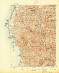
Editions of this 1903 Port Orford Map
7 editions found
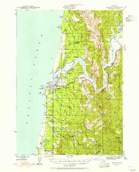
Other maps of this area

1896 · Coos Bay
USGS Topo · 1:125,000

1898 · Coos Bay
USGS Topo · 1:125,000

1899 · Port Orford
USGS Topo · 1:125,000

1900 · Coos Bay
USGS Topo · 1:125,000

1903 · Port Orford
USGS Topo · 1:125,000

1917 · Kerby
USGS Topo · 1:125,000

1918 · Kerby
USGS Topo · 1:125,000

1928 · Sitkum
USGS Topo · 1:125,000

1942 · Coquille
USGS Topo · 1:62,500
1943 · Bandon
USGS Topo · 1:62,500