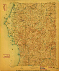
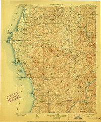
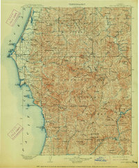
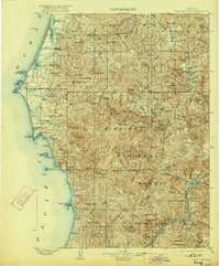
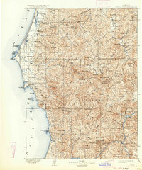
1903 Map of Port Orford
USGS Topo · Published 1911About this map
Cape Blanco and the surrounding coastline of the Pacific Ocean dominate this turn-of-the-century topographic study. The maritime character of the region is evident in landmarks like Blacklock Pt Tower Rock, The Heads, and Garrison Lagoon near Port Orford. Inland, the landscape rises sharply into a dense network of ridges and peaks, including Humbug Mt. and Bald Mountain. The settlement pattern follows the coastal terrace and river valleys, with small communities like Langlois, Denmark, and Frankport established along established travel corridors and water sources.
Find a feature on this map
134 named features on this map. Tap any name to fly to it.
Don’t see what you’re looking for? This feature index may not catch every label — zoom into the map to look around manually.
Map Details
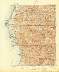
Editions of this 1903 Port Orford Map
7 editions found
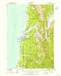
Other maps of this area

1896 · Coos Bay
USGS Topo · 1:125,000

1898 · Coos Bay
USGS Topo · 1:125,000

1899 · Port Orford
USGS Topo · 1:125,000

1900 · Coos Bay
USGS Topo · 1:125,000

1903 · Port Orford
USGS Topo · 1:125,000

1917 · Kerby
USGS Topo · 1:125,000

1918 · Kerby
USGS Topo · 1:125,000

1928 · Sitkum
USGS Topo · 1:125,000

1942 · Coquille
USGS Topo · 1:62,500
1943 · Bandon
USGS Topo · 1:62,500