
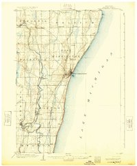
1904 Map of Port Washington
USGS Topo · Published 1904About this map
Port Washington serves as the focal point of this coastal survey, where the town's harbor and lighthouse L.H. meet the western edge of Lake Michigan. The landscape is defined by the parallel paths of industrial transport and natural waterways at the start of the century. The Chicago and Northwestern Ry and the Chicago Milwaukee and St. Paul Ry cut north-south through the county, linking established settlements like Grafton, Cedarburg, and Saukville. Inland, the Milwaukee River and Cedar Creek wind through the townships of Saukville and Grafton, providing the water power that historically fueled the region's early milling and manufacturing. Smaller clusters such as Holy Cross, Lake Church, and the depot at Fredonia Station illustrate the dense network of rural communities supporting the agricultural and maritime economy of early Ozaukee County.
Find a feature on this map
30 named features on this map. Tap any name to fly to it.
Don’t see what you’re looking for? This feature index may not catch every label — zoom into the map to look around manually.
Map Details
Editions of this 1904 Port Washington Map
2 editions found
Other maps of this area

1892 · Milwaukee
USGS Topo · 1:62,500

1892 · Waukesha
USGS Topo · 1:62,500

1892 · Port Washington
USGS Topo · 1:62,500

1901 · Milwaukee
USGS Topo · 1:62,500

1901 · Waukesha
USGS Topo · 1:62,500

1904 · West Bend
USGS Topo · 1:62,500

1906 · Waukesha
USGS Topo · 1:62,500

1906 · Milwaukee
USGS Topo · 1:62,500

1954 · Sheboygan Falls
USGS Topo · 1:62,500

1954 · Sheboygan South
USGS Topo · 1:62,500