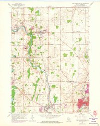
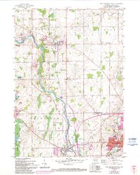
1959 Map of Port Washington West
USGS Topo · Published 1973About this map
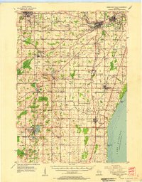
The Milwaukee River carves a winding path through this mid-century landscape, linking the industrial corridors of Port Washington and Saukville with the agricultural uplands to the north. At this time, the Chicago Milwaukee St Paul and Milwaukee Pacific railroad remained a primary artery for movement between the riverside settlements. Local life is documented through a dense network of country institutions, from the Smoky Hill Sch and Lakeland Sch to several denominationally distinct burial grounds such as St Rose Cem and the Norwegian Cem. The 1971 revisions, shown in purple, highlight the growth of residential blocks near Port Washington, contrasting with the preserved natural state of the Cedarburg Bog in the southwest corner. The transition from established river towns to more modern utility footprints is evident in the presence of the Ozaukee Landing Strip and multiple municipal gravel pits.
Find a feature on this map
51 named features on this map. Tap any name to fly to it.
Don’t see what you’re looking for? This feature index may not catch every label — zoom into the map to look around manually.
Map Details
Editions of this 1959 Port Washington West Map
3 editions found
Other maps of this area
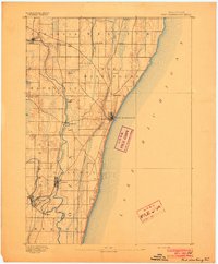
1892 · Port Washington
USGS Topo · 1:62,500

1904 · West Bend
USGS Topo · 1:62,500
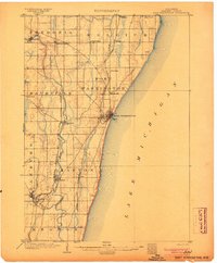
1904 · Port Washington
USGS Topo · 1:62,500
1954 · Sheboygan Falls
USGS Topo · 1:62,500

1954 · Milwaukee
USGS Topo · 1:250,000

1955 · Kewaskum
USGS Topo · 1:62,500

1957 · Madison
USGS Topo · 1:250,000

1958 · Milwaukee
USGS Topo · 1:250,000
1958 · Port Washington East
USGS Topo · 1:24,000
1959 · Port Washington West
USGS Topo · 1:24,000