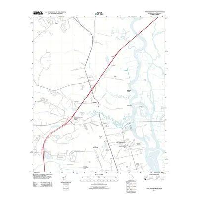
2011 Map of Port Wentworth
USGS Topo · Published 2011About this map
Port Wentworth sits at a critical junction of industry and coastal geography, where the Savannah River splits into a complex network of channels and marsh islands. This 2011 topographic survey highlights the area's development, showing the expansion of the Savannah International Airport and the presence of the Georgia Tech University Savannah Campus. The river itself is a maze of named cuts and islands, including Rhodes Cut, Houstown Cut, and Onslow Island, reflecting the engineered navigation essential to the region's maritime economy.
Find a feature on this map
94 named features on this map. Tap any name to fly to it.
Don’t see what you’re looking for? This feature index may not catch every label — zoom into the map to look around manually.
Map Details
Editions of this 2011 Port Wentworth Map
This is the sole edition of this map. No revisions or reprints were ever made.
Other maps of this area

1919 · Egypt
USGS Topo · 1:62,500

1920 · Hardeeville
USGS Topo · 1:62,500

1920 · Meldrim
USGS Topo · 1:62,500

1939 · Egypt
USGS Topo · 1:62,500

1942 · Meldrim
USGS Topo · 1:62,500

1942 · Savannah
USGS Topo · 1:62,500

1943 · Hardeeville
USGS Topo · 1:62,500

1943 · Egypt
USGS Topo · 1:62,500

1947 · Savannah
USGS Topo · 1:250,000

1948 · Savannah
USGS Topo · 1:250,000