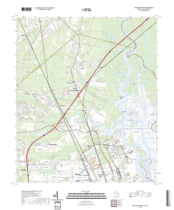
2024 Map of Port Wentworth
USGS Topo · Published 2024About this map
Savannah National Wildlife Refuge dominates the eastern landscape of this quadrangle, where the Savannah River splits into a complex network of channels including the Front River and Little Back River. The terrain is defined by tidal wetlands and islands such as Argyle Island and Onslow Island, partitioned by historical cuts like Rhodes Cut and McCoy's Cut. This modern survey illustrates the proximity of these protected marshes to heavy infrastructure, notably the Savannah/Hilton Head International Airport and the sprawling logistics corridors of Port Wentworth.
Find a feature on this map
62 named features on this map. Tap any name to fly to it.
Don’t see what you’re looking for? This feature index may not catch every label — zoom into the map to look around manually.
Map Details
Editions of this 2024 Port Wentworth Map
This is the sole edition of this map. No revisions or reprints were ever made.
Other maps of this area

1919 · Egypt
USGS Topo · 1:62,500

1920 · Hardeeville
USGS Topo · 1:62,500

1920 · Meldrim
USGS Topo · 1:62,500

1939 · Egypt
USGS Topo · 1:62,500

1942 · Meldrim
USGS Topo · 1:62,500

1942 · Savannah
USGS Topo · 1:62,500

1943 · Hardeeville
USGS Topo · 1:62,500

1943 · Egypt
USGS Topo · 1:62,500

1947 · Savannah
USGS Topo · 1:250,000

1948 · Savannah
USGS Topo · 1:250,000