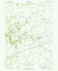
1955 Map of Port William
USGS Topo · Published 1968About this map
Anderson Fork and Painters Run wind through this agrarian landscape on the border of Greene and Clinton Counties. The village of Port William serves as a central hub, surrounded by smaller historical clusters such as Lumberton, Paintersville, and Middleton Corner. A distinct network of rural infrastructure is visible, including the Mt Tabor Ch, Caesar Creek Sch, and Mt Pleasant Sch. These small community centers, often situated at road intersections like the one at Gunnerville, define the settlement pattern of the mid-20th century.
Find a feature on this map
58 named features on this map. Tap any name to fly to it.
Don’t see what you’re looking for? This feature index may not catch every label — zoom into the map to look around manually.
Map Details
Editions of this 1955 Port William Map
Other maps of this area

1907 · Blanchester
USGS Topo · 1:62,500

1916 · Octa
USGS Topo · 1:62,500

1917 · Xenia
USGS Topo · 1:62,500

1917 · Sabina
USGS Topo · 1:62,500

1943 · Sabina
USGS Topo · 1:62,500

1944 · Octa
USGS Topo · 1:62,500

1947 · Columbus
USGS Topo · 1:250,000

1955 · New Burlington
USGS Topo · 1:24,000

1955 · Cedarville
USGS Topo · 1:24,000

1955 · Port William
USGS Topo · 1:24,000