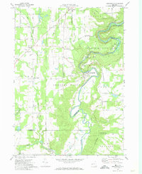
1972 Map of Portageville
USGS Topo · Published 1974About this map
The Genesee River carves a dramatic path through the heart of Letchworth State Park, dropping over three major cataracts: Upper Falls, Middle Falls, and Lower Falls. This 1972 survey captures the region as a mix of conservation land and active agricultural settlements. Small hamlets like Portageville, Wiscoy, and East Koy serve as local anchors, while the Erie-Lackawanna railroad traverses the terrain nearby. Genealogists will find several rural burial grounds, including Maple Hill Cem, Pennycook Cem, and Assumption Cem. The landscape is also dotted with evidence of local industry, from various Gravel Pits and a Quarry to a Gaging Sta along the river. This documentation provides a clear view of the intersection of Wyoming, Livingston, and Allegany counties before modern development altered the rural character of these river valley communities.
Find a feature on this map
62 named features on this map. Tap any name to fly to it.
Don’t see what you’re looking for? This feature index may not catch every label — zoom into the map to look around manually.
Map Details
Editions of this 1972 Portageville Map
Other maps of this area

1905 · Portage
USGS Topo · 1:62,500

1905 · Nunda
USGS Topo · 1:62,500

1906 · Angelica
USGS Topo · 1:62,500

1916 · Canaseraga
USGS Topo · 1:62,500

1940 · Canaseraga
USGS Topo · 1:62,500

1941 · Angelica
USGS Topo · 1:62,500

1943 · Mount Morris
USGS Topo · 1:24,000

1943 · Warsaw
USGS Topo · 1:24,000

1943 · Nunda
USGS Topo · 1:24,000

1943 · Castile
USGS Topo · 1:24,000