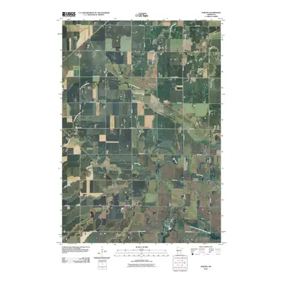
2010 Map of Porter
USGS Topo · Published 2010About this map
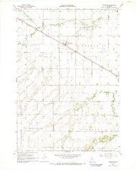
Porter serves as the primary hub of this southwestern Minnesota landscape, situated along the southern reaches of the quadrangle. The town is anchored by the Porter Post Office, while the surrounding prairie is defined by a dense grid of rural roads and the meandering courses of multiple waterways. The Lac qui Parle River cuts across the northwest, while Mud Creek and the North Branch Yellow Medicine River traverse the southern portion near the settlement. For those researching local heritage, the Wergeland Cemetery stands as a significant landmark in the southeastern countryside, marking the intersection of the natural drainage systems and the early agricultural infrastructure. The map illustrates a region where the precise township-and-range road system, including routes like County Hwy-15, must contend with the shifting paths of the prairie creeks and rivers.
Find a feature on this map
23 named features on this map. Tap any name to fly to it.
Don’t see what you’re looking for? This feature index may not catch every label — zoom into the map to look around manually.
Map Details
Editions of this 2010 Porter Map
This is the sole edition of this map. No revisions or reprints were ever made.
Other maps of this area

1953 · Watertown
USGS Topo · 1:250,000

1958 · Watertown
USGS Topo · 1:250,000

1967 · Canby
USGS Topo · 1:24,000

1967 · Dawson SW
USGS Topo · 1:24,000

1967 · Porter
USGS Topo · 1:24,000
1967 · Providence
USGS Topo · 1:24,000
1967 · Porter SW
USGS Topo · 1:24,000
1967 · St Leo
USGS Topo · 1:24,000

1967 · Gary SE
USGS Topo · 1:24,000
1967 · Taunton
USGS Topo · 1:24,000