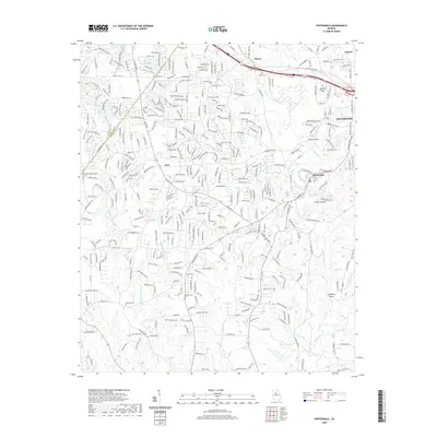
2020 Map of Porterdale
USGS Topo · Published 2020About this map
Porterdale and the western edge of Covington anchor this 2020 landscape, where the Yellow River winds through central Newton County. The river's path is marked by distinctive natural features such as Cedar Shoals and Langston Shoals, illustrating the hydraulic character of the Piedmont region. The map reveals a suburbanizing landscape where older communities like Almon and Oxford are connected by modern thoroughfares like I-20 and Ga 81. For genealogists, several burial sites are documented across the quadrangle, including Shiloh Cem near the northern boundary and Middlebrooks Cem to the south. Smaller water bodies like Paradise Lake and Bailey Lake are interspersed among residential developments, while the Rockdale and Newton County line bisects the western portion of the map, providing a clear view of the jurisdictional boundaries in this rapidly evolving area east of Atlanta.
Find a feature on this map
30 named features on this map. Tap any name to fly to it.
Don’t see what you’re looking for? This feature index may not catch every label — zoom into the map to look around manually.
Map Details
Editions of this 2020 Porterdale Map
This is the sole edition of this map. No revisions or reprints were ever made.
Other maps of this area

1888 · Atlanta
USGS Topo · 1:125,000

1890 · Atlanta
USGS Topo · 1:125,000

1892 · Atlanta
USGS Topo · 1:125,000

1895 · Atlanta
USGS Topo · 1:125,000

1896 · Monroe
USGS Topo · 1:125,000

1953 · Atlanta
USGS Topo · 1:250,000

1953 · Athens
USGS Topo · 1:250,000

1956 · Conyers
USGS Topo · 1:24,000

1957 · Atlanta
USGS Topo · 1:250,000

1958 · Athens
USGS Topo · 1:250,000