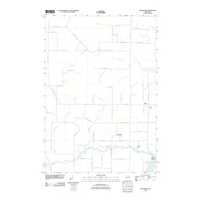
2010 Map of Porterfield
USGS Topo · Published 2010About this map
Peshtigo River meanders across the southern portion of this landscape, its waters widening into the Bagley Flowage 1061 near the rail junction of Bagley Junction. This 2010 survey reflects a rural Wisconsin community where agriculture and industry have long shaped the land, evidenced by the grid of county highways and family-named roads like Miles Rd and Jacobson Rd. The settlement of Porterfield serves as a central point, while the smaller community of Walsh sits to the northeast, adjacent to Saint Joseph Cemetery. Significant waterways including Twin Creek, Mud Brook, and Gravelly Brook drain the wooded and open acreage between these hubs. The map also identifies the Brown Memorial Camp along the riverbank, highlighting the area's recreational use of the river corridor.
Find a feature on this map
54 named features on this map. Tap any name to fly to it.
Don’t see what you’re looking for? This feature index may not catch every label — zoom into the map to look around manually.
Map Details
Editions of this 2010 Porterfield Map
This is the sole edition of this map. No revisions or reprints were ever made.
Other maps of this area

1939 · Marinette
USGS Topo · 1:48,000

1939 · Porterfield
USGS Topo · 1:48,000

1942 · Porterfield
USGS Topo · 1:48,000

1942 · Wausaukee
USGS Topo · 1:48,000

1947 · Wausaukee
USGS Topo · 1:48,000

1949 · Stephenson
USGS Topo · 1:48,000

1954 · Escanaba
USGS Topo · 1:250,000

1957 · Escanaba
USGS Topo · 1:250,000

1958 · Escanaba
USGS Topo · 1:250,000

1963 · Porterfield
USGS Topo · 1:62,500