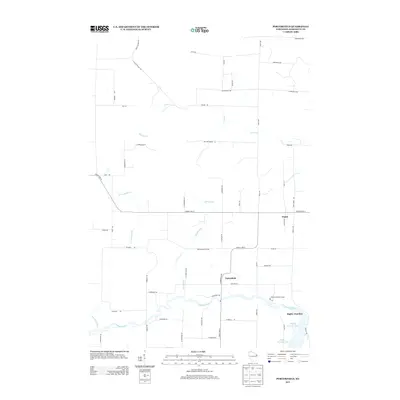
2013 Map of Porterfield
USGS Topo · Published 2013About this map
The Peshtigo River meanders across the southern portion of this landscape, anchoring the settlements of Porterfield and Bagley Junction. This area of Marinette County shows a distinct transition from the riverfront to the upland agricultural and timber lands north of the water. The confluence near Bagley Junction and the widening of the Bagley Flowage 1061 define the local hydrography, while the interior is marked by numerous watercourses including Twin Cr and Mud Brook.
Find a feature on this map
56 named features on this map. Tap any name to fly to it.
Don’t see what you’re looking for? This feature index may not catch every label — zoom into the map to look around manually.
Map Details
Editions of this 2013 Porterfield Map
This is the sole edition of this map. No revisions or reprints were ever made.
Other maps of this area

1939 · Marinette
USGS Topo · 1:48,000

1939 · Porterfield
USGS Topo · 1:48,000

1942 · Porterfield
USGS Topo · 1:48,000

1942 · Wausaukee
USGS Topo · 1:48,000

1947 · Wausaukee
USGS Topo · 1:48,000

1949 · Stephenson
USGS Topo · 1:48,000

1954 · Escanaba
USGS Topo · 1:250,000

1957 · Escanaba
USGS Topo · 1:250,000

1958 · Escanaba
USGS Topo · 1:250,000

1963 · Porterfield
USGS Topo · 1:62,500