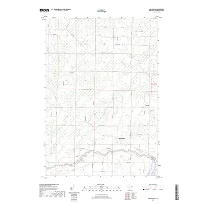
2018 Map of Porterfield
USGS Topo · Published 2018About this map
The Peshtigo River meanders across the southern landscape of Marinette County, defining the rural character of this region in the late 2010s. The unincorporated settlement of Porterfield serves as a central point for the surrounding farming and timber lands, while the smaller community of Walsh sits to the northeast along Co Hwy G. The terrain is characterized by extensive wetlands and drainage systems, including Twin Cr and Mud Brook, which weave through a network of local roads such as Porterfield Lake Rd. Near the eastern boundary, Bagley Junction marks a historic point of connection. Local heritage is preserved at Saint Joseph Cem, situated near the crossroads that link these isolated communities. The map detail highlights how the natural hydrology of brooks and river bends continues to dictate the placement of homes and transit routes like Spur Rd and Ferndale Rd.
Find a feature on this map
58 named features on this map. Tap any name to fly to it.
Don’t see what you’re looking for? This feature index may not catch every label — zoom into the map to look around manually.
Map Details
Editions of this 2018 Porterfield Map
This is the sole edition of this map. No revisions or reprints were ever made.
Other maps of this area

1939 · Marinette
USGS Topo · 1:48,000

1939 · Porterfield
USGS Topo · 1:48,000

1942 · Porterfield
USGS Topo · 1:48,000

1942 · Wausaukee
USGS Topo · 1:48,000

1947 · Wausaukee
USGS Topo · 1:48,000

1949 · Stephenson
USGS Topo · 1:48,000

1954 · Escanaba
USGS Topo · 1:250,000

1957 · Escanaba
USGS Topo · 1:250,000

1958 · Escanaba
USGS Topo · 1:250,000

1963 · Porterfield
USGS Topo · 1:62,500