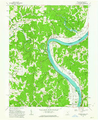
1960 Map of Portland
USGS Topo · Published 1963About this map
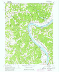
Ohio River commerce and rural Ohio valley life converge in this 1960 survey, centered on the bend at Portland. The landscape is defined by the sharp meanders of the Shade River and the expansive Shade River State Forest Park, which provides a natural backdrop to small riverfront settlements. Civil War history is anchored here at the Buffington Island State Memorial Mon, commemorating a rare battle on Ohio soil.
Find a feature on this map
93 named features on this map. Tap any name to fly to it.
Don’t see what you’re looking for? This feature index may not catch every label — zoom into the map to look around manually.
Map Details
Editions of this 1960 Portland Map
5 editions found
Other maps of this area

1906 · Belleville
USGS Topo · 1:62,500

1907 · Keno
USGS Topo · 1:62,500

1907 · Ripley
USGS Topo · 1:62,500

1908 · Ravenswood
USGS Topo · 1:62,500

1924 · Belleville
USGS Topo · 1:62,500

1926 · Ravenswood
USGS Topo · 1:62,500

1926 · Belleville
USGS Topo · 1:62,500

1926 · Ripley
USGS Topo · 1:62,500

1928 · Ravenswood
USGS Topo · 1:62,500

1928 · Ripley
USGS Topo · 1:62,500