
1950 Map of Portsmouth
USGS Topo · Published 1950About this map
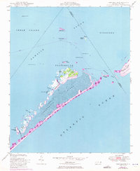
Portsmouth sits at the northern tip of Portsmouth Island, serving as a focal point for this 1950 coastal survey where the Pamlico Sound meets the Atlantic Ocean. The map documents a landscape of shifting sands and maritime navigation, tracing a telephone line that stretches across the marshes and dunes from the main settlement down toward the southwest. Navigational aids like the Wallace Channel Light and Sheep Island Slue Light emphasize the area's importance for vessels traversing Ocracoke Inlet. The terrain is characterized by intricate water features including Casey Bay, Evergreen Slough, and Daniel Swash. Distinctive landmarks such as Shell Castle and The High Hills provide points of reference on an island defined by its isolation and the constant influence of the surrounding tides.
Find a feature on this map
33 named features on this map. Tap any name to fly to it.
Don’t see what you’re looking for? This feature index may not catch every label — zoom into the map to look around manually.
Map Details
Editions of this 1950 Portsmouth Map
2 editions found
Other maps of this area

1948 · Portsmouth
USGS Topo · 1:24,000
1948 · Ocracoke
USGS Topo · 1:24,000

1950 · Howard Reef
USGS Topo · 1:24,000

1953 · Rocky Mount
USGS Topo · 1:250,000

1953 · Beaufort
USGS Topo · 1:250,000

1954 · Rocky Mount
USGS Topo · 1:250,000

1954 · Beaufort
USGS Topo · 1:250,000

1955 · Wanchese
USGS Topo · 1:250,000

1957 · Manteo
USGS Topo · 1:250,000

1960 · Manteo
USGS Topo · 1:250,000