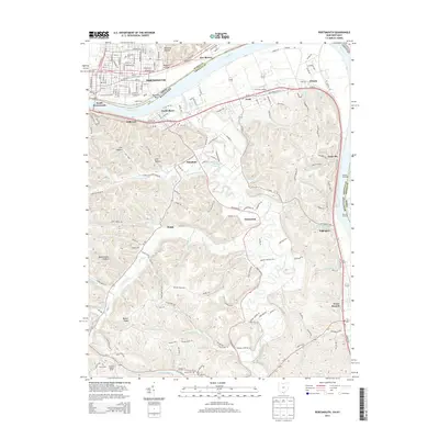
2013 Map of Portsmouth
USGS Topo · Published 2013About this map
The Ohio River carves a deep valley at the junction of Ohio and Kentucky, separating the city of Portsmouth from the riverfront towns of South Portsmouth and South Shore. This landscape is defined by the sharp contrast between the urban grid of New Boston and the heavily dissected ridges of the Kentucky interior. Local history is anchored by Shawnee State Univ and Greenlawn Cem on the northern bank, while the southern side reveals a network of hollows like Brewery Hollow and Mabert Hollow that lead into the uplands. Significant topographical features include Beauty Ridge and the winding course of Tygarts Creek, which flows past settlements like Maloneton and Sunshine. For those tracking family heritage, the map identifies small rural burial sites such as Fannin Cem and Howe Cem, along with landmarks like the Howland Lookout Tower and Pratters Landing along the riverbanks.
Find a feature on this map
173 named features on this map. Tap any name to fly to it.
Don’t see what you’re looking for? This feature index may not catch every label — zoom into the map to look around manually.
Map Details
Editions of this 2013 Portsmouth Map
This is the sole edition of this map. No revisions or reprints were ever made.
Other maps of this area

1911 · Sciotoville
USGS Topo · 1:62,500

1913 · Sciotoville
USGS Topo · 1:62,500

1915 · Garrison
USGS Topo · 1:62,500

1915 · Otway
USGS Topo · 1:62,500

1917 · Otway
USGS Topo · 1:62,500

1918 · Garrison
USGS Topo · 1:62,500

1926 · Greenup
USGS Topo · 1:48,000

1930 · Greenup
USGS Topo · 1:62,500

1949 · Friendship
USGS Topo · 1:24,000

1949 · Brushart
USGS Topo · 1:24,000