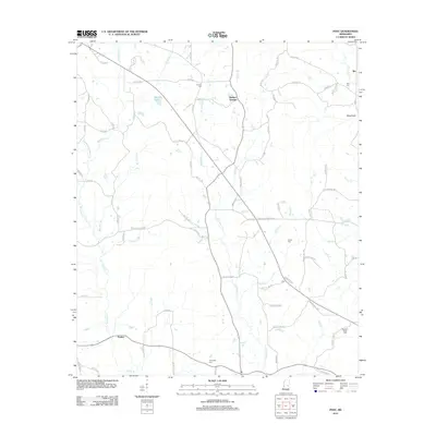
2012 Map of Post
USGS Topo · Published 2012About this map
Tallahatta Cr meanders through this portion of Newton County, shaping a landscape defined by its numerous tributaries like Big John Br and Threat Br. The small settlement of Post serves as a central point in a network of rural routes, including Post Colin Rd and McMillan Rd. To the west, Perdue sits near the winding Reese Br, while Herbert Springs marks the northern reaches of the quadrangle. For those researching family history, the map identifies several local burial grounds such as Antioch Cem and Friendship Cem. The presence of the King Canal and Joyner Lake reflects the localized water management and land use patterns of this Mississippi region in the early 21st century.
Find a feature on this map
82 named features on this map. Tap any name to fly to it.
Don’t see what you’re looking for? This feature index may not catch every label — zoom into the map to look around manually.
Map Details
Editions of this 2012 Post Map
This is the sole edition of this map. No revisions or reprints were ever made.
Other maps of this area

1953 · Meridian
USGS Topo · 1:250,000

1957 · Meridian
USGS Topo · 1:250,000

1957 · Chunky
USGS Topo · 1:62,500

1962 · House
USGS Topo · 1:24,000

1962 · Center Hill
USGS Topo · 1:24,000

1962 · Post
USGS Topo · 1:24,000

1962 · Moscow
USGS Topo · 1:24,000

1965 · Meridian
USGS Topo · 1:250,000

1966 · Decatur
USGS Topo · 1:24,000

1972 · Deemer
USGS Topo · 1:24,000