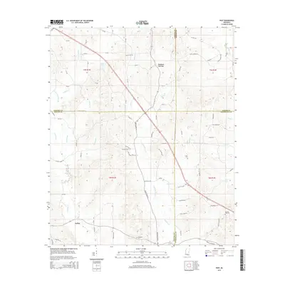
2015 Map of Post
USGS Topo · Published 2015About this map
Herbert Springs and the small settlements of Post and Perdue anchor this rural landscape where Neshoba, Newton, Kemper, and Lauderdale counties meet. The terrain is defined by an intricate network of watercourses, most notably Tallahatta Cr and Tallashua Cr, which carve through the countryside alongside smaller tributaries like Threat Br and Murphy Br. This 2015 survey illustrates a community deeply rooted in its local geography, with a road network that reflects long-standing family and agricultural connections, including Chunky Duffee Rd and Pleasant Grove Rd. Genealogists will find significant value in the distribution of community landmarks, including Antioch Cem, Zion Cem, and Friendship Cem, which serve as physical markers of the area's social history. The map also records early transport corridors such as Old Highway 19 N, tracing the evolution of movement through these central Mississippi hills.
Find a feature on this map
57 named features on this map. Tap any name to fly to it.
Don’t see what you’re looking for? This feature index may not catch every label — zoom into the map to look around manually.
Map Details
Editions of this 2015 Post Map
This is the sole edition of this map. No revisions or reprints were ever made.
Other maps of this area

1953 · Meridian
USGS Topo · 1:250,000

1957 · Meridian
USGS Topo · 1:250,000

1957 · Chunky
USGS Topo · 1:62,500

1962 · House
USGS Topo · 1:24,000

1962 · Center Hill
USGS Topo · 1:24,000

1962 · Post
USGS Topo · 1:24,000

1962 · Moscow
USGS Topo · 1:24,000

1965 · Meridian
USGS Topo · 1:250,000

1966 · Decatur
USGS Topo · 1:24,000

1972 · Deemer
USGS Topo · 1:24,000