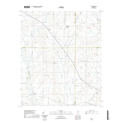
2020 Map of Post
USGS Topo · Published 2020About this map
Tallahatta Cr and its many tributaries, including Mayatte Cr and Big John Br, define the drainage patterns across this intersection of Neshoba, Newton, Kemper, and Lauderdale Counties. The landscape is marked by small settlements such as Perdue, Herbert Springs, Rio, and Post, linked by a network of rural routes like Chunky Duffee Rd and Russell Rd. Local history is anchored by several rural burying grounds, including Antioch Cem and Zion Cem, which serve as permanent markers of family lineage in this part of Mississippi. The topography is characterized by low-lying wetland features like Double Reed Brake Br and smaller bodies of water such as Joyner Lake. This area reflects a long-standing agricultural and timber-based character where county boundaries meet in a complex of creeks and local roads.
Find a feature on this map
80 named features on this map. Tap any name to fly to it.
Don’t see what you’re looking for? This feature index may not catch every label — zoom into the map to look around manually.
Map Details
Editions of this 2020 Post Map
This is the sole edition of this map. No revisions or reprints were ever made.
Other maps of this area

1953 · Meridian
USGS Topo · 1:250,000

1957 · Meridian
USGS Topo · 1:250,000

1957 · Chunky
USGS Topo · 1:62,500

1962 · House
USGS Topo · 1:24,000

1962 · Center Hill
USGS Topo · 1:24,000

1962 · Post
USGS Topo · 1:24,000

1962 · Moscow
USGS Topo · 1:24,000

1965 · Meridian
USGS Topo · 1:250,000

1966 · Decatur
USGS Topo · 1:24,000

1972 · Deemer
USGS Topo · 1:24,000