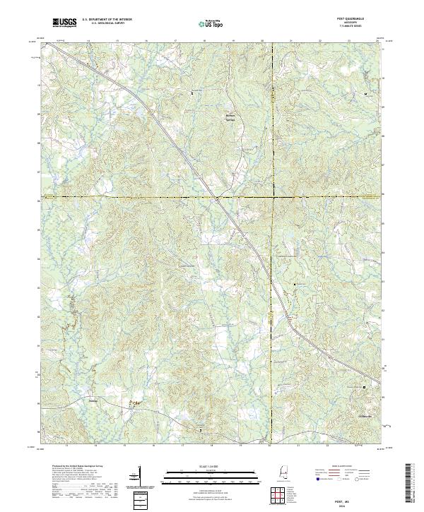
2024 Map of Post
USGS Topo · Published 2024About this map
Herbert Springs and the rural crossroads of Perdue anchor this landscape where the boundaries of Neshoba, Newton, Kemper, and Lauderdale counties converge. The terrain is defined by a dense network of waterways, including the winding course of Tallahatta Creek and its many tributaries like Double Reed Brake Branch and Big John Branch. The settlement pattern follows established ridge roads and section lines, with small family and community burial grounds such as Antioch Cem and Friendship Cem located near early homestead sites.
Find a feature on this map
82 named features on this map. Tap any name to fly to it.
Don’t see what you’re looking for? This feature index may not catch every label — zoom into the map to look around manually.
Map Details
Editions of this 2024 Post Map
This is the sole edition of this map. No revisions or reprints were ever made.
Other maps of this area

1953 · Meridian
USGS Topo · 1:250,000

1957 · Meridian
USGS Topo · 1:250,000

1957 · Chunky
USGS Topo · 1:62,500

1962 · House
USGS Topo · 1:24,000

1962 · Center Hill
USGS Topo · 1:24,000

1962 · Post
USGS Topo · 1:24,000

1962 · Moscow
USGS Topo · 1:24,000

1965 · Meridian
USGS Topo · 1:250,000

1966 · Decatur
USGS Topo · 1:24,000

1972 · Deemer
USGS Topo · 1:24,000