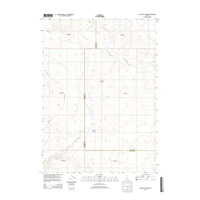
2013 Map of Pot Hole Canyon
USGS Topo · Published 2013About this map
The Bruneau Desert defines this high desert landscape along the border of Elmore and Owyhee counties in southern Idaho. The area is characterized by drainage systems that cut through the arid terrain, most notably the deep impressions of Pot Hole Canyon and the seasonal flows of Sailor Creek. This 2013 survey provides a clear view of the complex hydrography in a region where water sources like Pot Hole Cr and Pot-Hole Cr have historically dictated movement and land use.
Find a feature on this map
15 named features on this map. Tap any name to fly to it.
Don’t see what you’re looking for? This feature index may not catch every label — zoom into the map to look around manually.
Map Details
Editions of this 2013 Pot Hole Canyon Map
This is the sole edition of this map. No revisions or reprints were ever made.
Other maps of this area

1947 · Indian Cove
USGS Topo · 1:24,000

1947 · Hammett
USGS Topo · 1:24,000

1947 · Glenns Ferry
USGS Topo · 1:24,000

1948 · Hammett
USGS Topo · 1:24,000

1948 · Glenns Ferry
USGS Topo · 1:24,000

1948 · Indian Cove
USGS Topo · 1:24,000

1948 · Indian Cove
USGS Topo · 1:62,500

1948 · Glenns Ferry
USGS Topo · 1:62,500

1948 · Pence Butte
USGS Topo · 1:24,000

1948 · Grindstone Butte
USGS Topo · 1:24,000