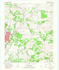
1968 Map of Poteau East
USGS Topo · Published 1980About this map
The Poteau River meanders across this landscape, forming a complex network of oxbows and marshy lowlands in the late 1960s. The regional seat of Poteau anchors the southwestern quadrant, showing a detailed street grid including Oklahoma Ave and McKenna Ave, alongside critical local infrastructure like the Hospital and High School. Industrial activity is evident through the presence of several strip mines and a Quarry in the eastern hills, highlighting the extraction-based economy of Le Flore County during this era.
Find a feature on this map
47 named features on this map. Tap any name to fly to it.
Don’t see what you’re looking for? This feature index may not catch every label — zoom into the map to look around manually.
Map Details
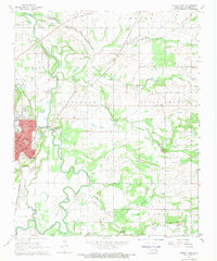
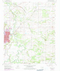
Editions of this 1968 Poteau East Map
3 editions found
Other maps of this area

1887 · Poteau Mountain #2
USGS Topo · 1:62,500

1887 · Greenwood
USGS Topo · 1:62,500

1890 · Fort Smith
USGS Topo · 1:125,000

1890 · Poteau Mountain
USGS Topo · 1:125,000

1899 · Poteau Mountain
USGS Topo · 1:125,000

1900 · Sallisaw
USGS Topo · 1:125,000

1900 · Winding Stair
USGS Topo · 1:125,000

1909 · Winding Stair
USGS Topo · 1:125,000

1911 · Sallisaw
USGS Topo · 1:125,000

1943 · Fort Smith
USGS Topo · 1:125,000