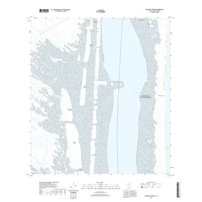
2019 Map of Potrero Cortado
USGS Topo · Published 2019About this map
Padre Island National Seashore and the complex salt flats of the Laguna Madre define this coastal reach in Kenedy County. The landscape is characterized by a series of potreros—elevated lands or pastures within the marshy flats—including Potrero Cortado, Potrero Grande, and Potrero Farias. These features represent stable ground amidst a shifting environment of shallow water and wetlands, long utilized for cattle grazing in this sparsely populated stretch of South Texas. The inland waterway is marked by the Land Cut, a significant navigational feature that bypasses the natural shallows of the laguna. To the east, the barrier of Padre Island separates the quiet waters of The Hole and Middle Ground from the open Gulf of Mexico, illustrating the delicate geomorphology of the Texas coastline before it meets the sea.
Find a feature on this map
13 named features on this map. Tap any name to fly to it.
Don’t see what you’re looking for? This feature index may not catch every label — zoom into the map to look around manually.
Map Details
Editions of this 2019 Potrero Cortado Map
This is the sole edition of this map. No revisions or reprints were ever made.
Other maps of this area

1923 · Lopena Island
USGS Topo · 1:62,500

1923 · Saltillo Ranch
USGS Topo · 1:62,500

1928 · Sarita
USGS Topo · 1:125,000

1950 · Corpus Christi
USGS Topo · 1:250,000

1951 · Potrero Lopeno NW
USGS Topo · 1:24,000

1951 · Sarita 4 NE
USGS Topo · 1:24,000

1952 · Potrero Cortado
USGS Topo · 1:24,000

1952 · Yarborough Pass
USGS Topo · 1:24,000

1952 · Sarita 4 SE
USGS Topo · 1:24,000

1952 · Potrero Lopeno
USGS Topo · 1:62,500