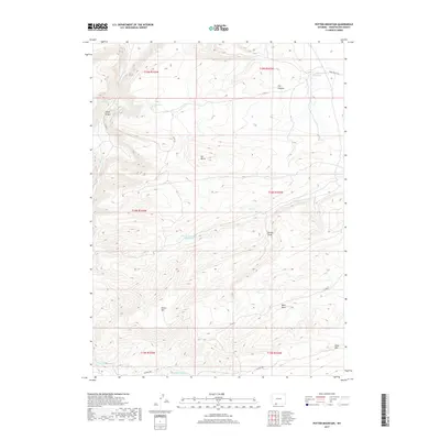
2017 Map of Potter Mountain
USGS Topo · Published 2017About this map
Potter Mtn anchors the high country of Sweetwater County in this high-desert survey. The landscape is defined by an intricate network of drainage systems and intermittent water sources essential for life in this arid region, such as Jim Washum Spring, Laney Spring, and Pio Spring. Human presence is marked by a sparse system of access routes like Co RD 76 and BLM RD 4405, which navigate between prominent landforms like Elk Butte and the sheer edge of Rifes Rim. The placement of Potter Mountain Reservoir and Pio Reservoir illustrates the careful management of water resources in a terrain sculpted by erosional features like Laney Canyon and Brooks Draw. This map captures the intersection of ranching infrastructure and the natural topography of the Wyoming basin.
Find a feature on this map
23 named features on this map. Tap any name to fly to it.
Don’t see what you’re looking for? This feature index may not catch every label — zoom into the map to look around manually.
Map Details
Editions of this 2017 Potter Mountain Map
This is the sole edition of this map. No revisions or reprints were ever made.
Other maps of this area

1954 · Rock Springs
USGS Topo · 1:250,000

1958 · Rock Springs
USGS Topo · 1:250,000

1962 · Rock Springs
USGS Topo · 1:250,000
1963 · Titsworth Gap
USGS Topo · 1:24,000

1963 · Four J Rim
USGS Topo · 1:24,000
1963 · Potter Mountain
USGS Topo · 1:24,000
1963 · Red Creek Ranch
USGS Topo · 1:24,000

1963 · Erickson-Kent Ranch
USGS Topo · 1:24,000

1963 · Scrivner Butte
USGS Topo · 1:24,000

1968 · Mud Springs Ranch
USGS Topo · 1:24,000