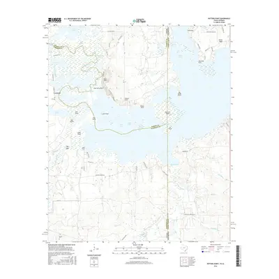
2016 Map of Potters Point
USGS Topo · Published 2016About this map
Uncertain and the surrounding labyrinth of Caddo Lake define this borderland where Texas meets Louisiana. The landscape is a complex network of bayous, chutes, and brakes, reflecting a hydrology where the line between land and water remains fluid. Named features like Whangdoodle Pass, Fish Net Gap, and Alligator Bayou suggest a long history of local navigation through the cypress-choked waters. Significant landforms rise above the wetlands, including Pine Bluff and Potters Point, which have served as stable anchors for settlement and transport in an area dominated by seasonal flooding and shifting channels.
Find a feature on this map
80 named features on this map. Tap any name to fly to it.
Don’t see what you’re looking for? This feature index may not catch every label — zoom into the map to look around manually.
Map Details
Editions of this 2016 Potters Point Map
This is the sole edition of this map. No revisions or reprints were ever made.
Other maps of this area

1932 · Hosston SW
USGS Topo · 1:31,680

1944 · Kildare
USGS Topo · 1:62,500

1944 · Caddo Lake
USGS Topo · 1:62,500

1946 · Caddo Lake
USGS Topo · 1:62,500

1948 · Kildare
USGS Topo · 1:62,500

1948 · Mooringsport
USGS Topo · 1:62,500

1948 · Vivian
USGS Topo · 1:62,500

1955 · Shreveport
USGS Topo · 1:250,000

1955 · Mooringsport
USGS Topo · 1:62,500

1956 · Shreveport
USGS Topo · 1:250,000