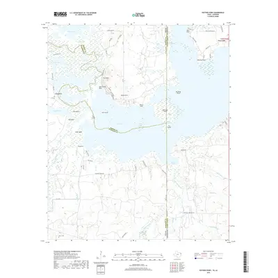
2019 Map of Potters Point
USGS Topo · Published 2019About this map
Uncertain and the surrounding Cypress Valley landscape are defined by a complex network of wetlands and bayous along the border of Texas and Louisiana. This map documents a labyrinthine aquatic environment where Caddo Lake meets the Big Cypress Bayou, characterized by numerous islands like Pine Island and Big Sandy Island, and specialized terrain features such as Whangdoodle Pass and Alligator Bayou. The interface between land and water is particularly intricate here, with numerous sloughs, brakes, and arms creating a semi-terrestrial geography that has long influenced local navigation and settlement patterns.
Find a feature on this map
81 named features on this map. Tap any name to fly to it.
Don’t see what you’re looking for? This feature index may not catch every label — zoom into the map to look around manually.
Map Details
Editions of this 2019 Potters Point Map
This is the sole edition of this map. No revisions or reprints were ever made.
Other maps of this area

1932 · Hosston SW
USGS Topo · 1:31,680

1944 · Kildare
USGS Topo · 1:62,500

1944 · Caddo Lake
USGS Topo · 1:62,500

1946 · Caddo Lake
USGS Topo · 1:62,500

1948 · Kildare
USGS Topo · 1:62,500

1948 · Mooringsport
USGS Topo · 1:62,500

1948 · Vivian
USGS Topo · 1:62,500

1955 · Shreveport
USGS Topo · 1:250,000

1955 · Mooringsport
USGS Topo · 1:62,500

1956 · Shreveport
USGS Topo · 1:250,000