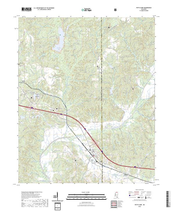
2024 Map of Potts Camp
USGS Topo · Published 2024About this map
Potts Camp serves as a primary point of interest in this Marshall County landscape, where the town layout is defined by the intersection of S Center St, E Front Ave, and Church St. The area transitions from the organized streets of Potts Camp to the expansive woodlands of the Holly Springs National Forest, which covers much of the central terrain. Waterways like the Tippah River and Oaklimeter Creek snake through the bottomlands, while Chewalla Lake provides a focal point for recreation in the north.
Find a feature on this map
68 named features on this map. Tap any name to fly to it.
Don’t see what you’re looking for? This feature index may not catch every label — zoom into the map to look around manually.
Map Details
Editions of this 2024 Potts Camp Map
This is the sole edition of this map. No revisions or reprints were ever made.
Other maps of this area

1944 · Potts Camp
USGS Topo · 1:62,500

1945 · Potts Camp
USGS Topo · 1:62,500

1950 · Ashland
USGS Topo · 1:62,500

1953 · Holly Springs
USGS Topo · 1:62,500

1955 · Blue Mountain
USGS Topo · 1:62,500

1956 · Tupelo
USGS Topo · 1:250,000

1958 · Tupelo
USGS Topo · 1:250,000

1964 · Waterford
USGS Topo · 1:24,000

1964 · Holly Springs SE
USGS Topo · 1:24,000
1965 · Holly Springs
USGS Topo · 1:24,000