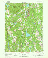
1960 Map of Pound Ridge
USGS Topo · Published 1973About this map
The Ward Pound Ridge Reservation dominates the northern reaches of this borderlands landscape, where the rugged topography of Westchester and Fairfield Counties meets. In the early 1960s, this region was characterized by its sophisticated transition from rural estates to suburban enclaves, anchored by established hamlets like Pound Ridge and Scotts Corners. The map meticulously records the complex water management system of the era, featuring significant catchments such as the Laurel Reservoir, Mianus Reservoir, and Siscowit Reservoir, which define the drainage patterns of the Mianus Gorge.
Find a feature on this map
81 named features on this map. Tap any name to fly to it.
Don’t see what you’re looking for? This feature index may not catch every label — zoom into the map to look around manually.
Map Details
Editions of this 1960 Pound Ridge Map
4 editions found
Other maps of this area

1892 · Stamford
USGS Topo · 1:62,500

1892 · Danbury
USGS Topo · 1:62,500

1892 · Norwalk
USGS Topo · 1:62,500

1892 · Carmel
USGS Topo · 1:62,500

1893 · Carmel
USGS Topo · 1:62,500

1893 · Stamford
USGS Topo · 1:62,500

1893 · Norwalk
USGS Topo · 1:62,500

1894 · Carmel
USGS Topo · 1:62,500

1899 · Stamford
USGS Topo · 1:62,500

1915 · Danbury
USGS Topo · 1:62,500