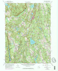
1960 Map of Pound Ridge
USGS Topo · Published 1973About this map
Ward Pound Ridge Reservation dominates the northern reaches of this landscape, where the Cross River Reservoir and Lake Kitchawan frame a terrain defined by narrow ridges and deep hollows like Honey Hollow and Wildcat Hollow. This mid-century survey captures the suburbanizing borderlands between Westchester County, New York, and Fairfield County, Connecticut, just as modern developments began to surround traditional village centers like Pound Ridge and Scotts Corners. The map provides a detailed record of the region's extensive water infrastructure, showing the Mianus Reservoir, Laurel Reservoir, and Trinity Lake which serve the growing coastal population. Genealogists will find a dense concentration of family burial grounds, including the Chichester Cem, Williams Cem, and the Waterbury Mem Cem, offering clues to the area's early settlement history before the arrival of private estates and clubs like the New Canaan Country Club.
Find a feature on this map
83 named features on this map. Tap any name to fly to it.
Don’t see what you’re looking for? This feature index may not catch every label — zoom into the map to look around manually.
Map Details
Editions of this 1960 Pound Ridge Map
4 editions found
Other maps of this area

1892 · Stamford
USGS Topo · 1:62,500

1892 · Danbury
USGS Topo · 1:62,500

1892 · Norwalk
USGS Topo · 1:62,500

1892 · Carmel
USGS Topo · 1:62,500

1893 · Carmel
USGS Topo · 1:62,500

1893 · Stamford
USGS Topo · 1:62,500

1893 · Norwalk
USGS Topo · 1:62,500

1894 · Carmel
USGS Topo · 1:62,500

1899 · Stamford
USGS Topo · 1:62,500

1915 · Danbury
USGS Topo · 1:62,500