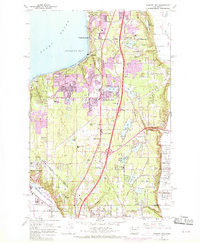
1961 Map of Poverty Bay
USGS Topo · Published 1969About this map
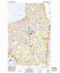
Puget Sound shoreline communities and inland lakes define this coastal corridor during a period of rapid suburban transformation between Seattle and Tacoma. The coastal settlements of Woodmont Beach, Redondo, and Lakota occupy the bluffs above Poverty Bay, while the interior shows the early infrastructure of Federal Way. Purple revisions from 1968 illustrate the expanding urban footprint into former timber or agricultural lands. The landscape is dotted with small bodies of water like Star Lake, Steel Lake, and Fivemile Lake, often accompanied by local landmarks such as Evergreen Airport and the Auburn Cem. The southern edge of the map captures the transition into the industrial and rail-influenced lowlands of Fife and Pacific, as well as the steep terrain of Peasley Canyon leading toward the Green River valley. Historical markers like the Indian Reservation Bdy near the Hylebos Waterway provide important genealogical and geographic context for the region's development.
Find a feature on this map
55 named features on this map. Tap any name to fly to it.
Don’t see what you’re looking for? This feature index may not catch every label — zoom into the map to look around manually.
Map Details
Editions of this 1961 Poverty Bay Map
5 editions found
Other maps of this area

1897 · Tacoma
USGS Topo · 1:125,000

1900 · Tacoma
USGS Topo · 1:125,000

1941 · Tacoma South
USGS Topo · 1:62,500

1942 · Lake Tapps
USGS Topo · 1:62,500

1944 · Lake Tapps
USGS Topo · 1:62,500

1944 · Tacoma South
USGS Topo · 1:62,500

1949 · Tacoma North
USGS Topo · 1:24,000

1949 · Poverty Bay
USGS Topo · 1:24,000

1949 · Renton
USGS Topo · 1:24,000
1949 · Des Moines
USGS Topo · 1:24,000