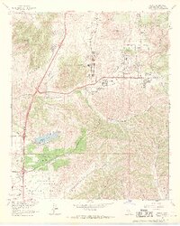
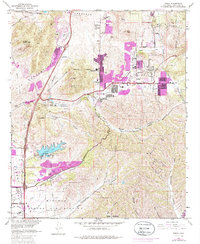
1967 Map of Poway
USGS Topo · Published 1970About this map
Poway appears as a growing inland community in the late 1960s, defined by its numerous educational facilities such as Poway High Sch, Midland Sch, and Pomerado Sch. The residential expansion is bounded by the natural contours of Twin Peaks and the prominent heights of Black Mountain. To the south, the massive footprint of the Miramar Naval Air Station and the U S Naval Res dominate the landscape of Kearny Mesa, reflecting the significant military presence that shaped the region's mid-century development.
Find a feature on this map
42 named features on this map. Tap any name to fly to it.
Don’t see what you’re looking for? This feature index may not catch every label — zoom into the map to look around manually.
Map Details
Editions of this 1967 Poway Map
5 editions found
Other maps of this area

1893 · El Cajon
USGS Topo · 1:62,500

1893 · Escondido
USGS Topo · 1:62,500

1901 · Elcajon
USGS Topo · 1:62,500

1901 · Escondido
USGS Topo · 1:62,500

1901 · San Luis Rey
USGS Topo · 1:125,000

1903 · Cuyamaca
USGS Topo · 1:125,000

1903 · La Jolla
USGS Topo · 1:62,500

1903 · Elcajon
USGS Topo · 1:62,500

1903 · Ramona
USGS Topo · 1:125,000

1904 · Southern California Sheet No. 2
USGS Topo · 1:250,000